Summary
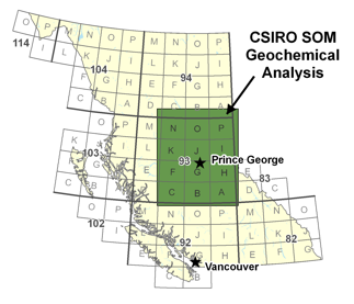
CSIRO Exploration & Mining has used a Self-Organizing Map approach to analyze a database of stream and lake sediment geochemical analytical results compiled and collected as part of the Geoscience BC's QUEST Project.
 The study's objective was to use CSIRO's implementation of the Self-Organizing Map (SiroSOM) to identify patterns and establish relationships amongst the various stream sediment and lake sediment geochermical data that may be indicative of geochemical dispersion related to mineralization. Anomalous samples and some spatially-coherent responses for some elements result from the study.