Summary
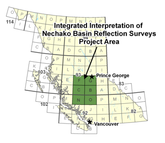
The Nechako Basin, which is located in the interior plateau of British Columbia between the Coast Mountains and the Rocky Mountains, has seen very little exploration for hydrocarbons, in marked contrast to the western Canadian sedimentary basin. The structure and hydrocarbon potential of the basin is poorly understood.
As part of a previous Geoscience BC project at Simon Fraser University, 1,650 km of seismic data acquired in the Nechako basin by Canadian Hunter have been interpreted and integrated with magnetic and gravity data. In addition, shallow (<1000 m depth) P wave velocity models have been derived along the linear survey profiles using tomographic inversion of first arrival travel times.
This project extends the work to the seismic survey that will be acquired by Geoscience BC in Nechako basin. The survey provided a regional context to the older, more focused seismic surveys, including a better defined relation between the sedimentary sub-basins and the evolution of the underlying igneous crust, which should be better imaged. The longer recording spreads of the 2008 survey, which will have offsets up to 14.4 km, should also allow discrimination of sedimentary lithologies from igneous rocks to depths of approximately 2 km, complementing the interpretation of the reflection images. With integration of the 1980s and 2008 seismic data with existing gravity/magnetic data, the along-strike extent of the prospective NNW-trending Cretaceous rocks exposed in the Nazko river valley, and drilled by Canadian Hunter, should be better defined.
Extensive Tertiary basalt flows of the Chilcotin, Endako, and Ootsa Lake groups cover most of the Nechako Basin, and up to date, no discoveries have been made in this region. The inability to define prospects results from the lack of clear reflections in many areas due to the heterogeneous subsurface geology and the effects of near-surface volcanic rocks on seismic imaging. Basin analysis identified that petroleum systems in the area reside mainly within Jurassic and Cretaceous lithologies, which remain poorly imaged and in many instances unknown. Due to the complexity of the velocity model, post-stack time migrations of the 2008 Geoscience BC long-offset two-dimensional (2-D) seismic data show no dramatic improvement, with almost no coherent data below the basaltic lavas. However, significant progress in deciphering the complex geology can be made using 3-D tomographic imaging of velocity structures, when correlated with surface geology, seismic data, borehole information and laboratory velocity measurements. Tomographic velocity modelling suggests the existence of faults and velocity inversions, and a number of several buried intrusive bodies of various ages have been identified in the area.