Summary
The purpose of the project is to increase the number of ASTER (Advanced Spaceborne Thermal Emission and Reflection Radiometer) images available through the MapPlace to the exploration community in British Columbia. A number of ASTER based products have been developed and will be provided for all new imagery.
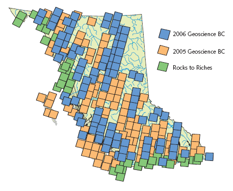
Previous projects have made 138 ASTER images and derivative products available through the Image Analysis Toolkit (IAT) portion of the MapPlace. Significant regions and gaps between existing images remain unrepresented in this database. ASTER imagery with its 14 spectral bands and one back-looking band provide information in the visible, near infrared (VNIR), short wave infrared (SWIR) and thermal infrared (TIR) range of the electromagnetic spectrum as well as the ability to generate stereo images.

New images will be orthorectified and atmospherically corrected and then added to the IAT for online image analysis by MapPlace users. The most recent good quality imagery with the maximum possible rock exposure will be selected. A number of derivative products will be provided for each image.
ASTER products will include:
- Downloadable copy of the original ASTER data
- Downloadable DEM generated from the ASTER data
- Inclusion of the atmospherically corrected and orthorectified data in the IAT
- Downloadable anaglyph images for 3D viewing
- Anaglyph image based MapPlace maps
- Downloadable orthorectified stereo pair images
- Downloadable virtual worlds for desktop analysis
- Mineral Alteration Maps (4 commonly used band combinations)
- Google Earth views of each ASTER image and associated Mineral Alteration Maps.