SEARCH

Key Researcher(s):  CGG Canada Services Ltd.ArrayPrecision GeoSurveys Inc.ArraySander Geophysics Ltd.

Project ID(s):  2015-SEA03, 2016-SEA02, 2017-SEA02

Key Research Organization(s):  CGG Canada Services Ltd., Precision GeoSurveys Inc., Sander Geophysics Ltd.

Project Location:  Bulkley Nechako, Omineca, Skeena

Strategic Focus Area:  Minerals

Summary


Search was a program of three regional airborne geophysical surveys flown across British Columbia’s Northwest, North Central and Northeast Regions between 2015 and 2017. The surveys were designed to highlight geology where mineral deposits might be to help exploration companies, First Nations and governments to plan future land use and to attract investment to BC.

Each survey used magnetometers to record local magnetic variations in the upper region of the Earth's crust. Phases II and III also recorded radiometric (background radioactivity) data to better understand local geology and alteration.

The Search program surveyed 40,300 km2 – an area roughly the size of Switzerland. The regional-scale of the surveys allows broad interpretation of regional mineral potential, while the relatively narrow survey line spacing at 250 meters allows detailed interpretations at a property-scale.

View Search Projects map


Previous
Next


Search Phase III: Airborne Magnetic and Radiometric Survey

Search Phase III covered a 9,600 square kilometres remote area of northern BC from the Kemess Underground mine project in the north to an area northwest of Mackenzie. This survey collected both magnetic and radiometric data and was conducted using helicopters flying a constant 80 m above the ground.

View Project


Search Phase II: Airborne Magnetic and Radiometric Survey
Search Phase I: Airborne Magnetic Survey


Benefits

Public, high quality and independent earth science generated by Search helps attract mineral exploration investment to the province that creates jobs and builds diverse, sustainable communities.

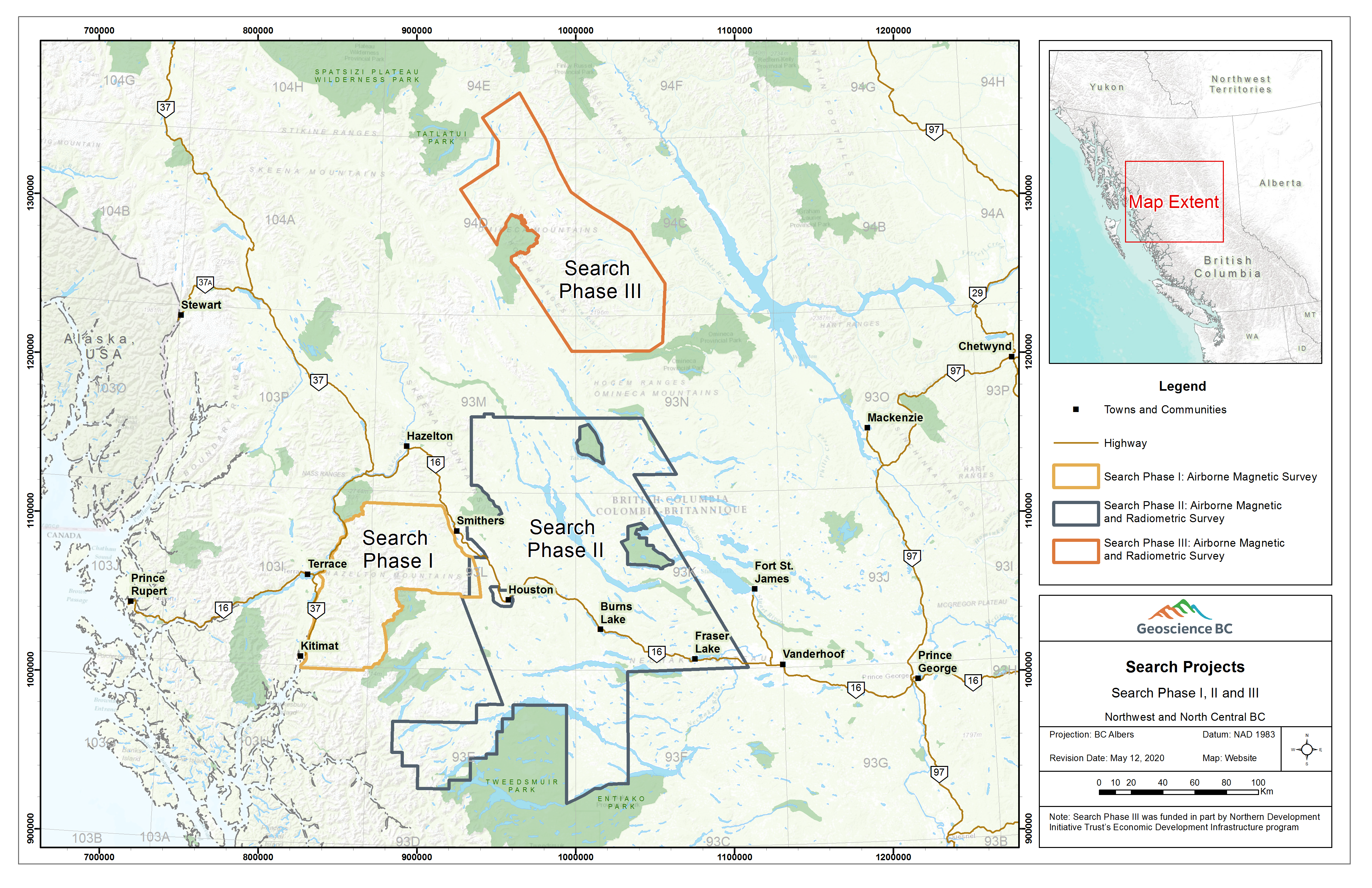
Modern, up-to-date survey data helps companies and individual mineral explorers decide where to focus their mineral exploration activities. This, in turn, helps stimulate regional economic activity through the procurement of local goods and services. Regional magnetic surveying had not been conducted on some portions of the Search area since the 1960s. Technology and accuracy has improved significantly since then.

Data generated from the Search program can be used to help Indigenous groups, regional districts, governments and local communities to understand potential mineral resources in their area to make informed resource-management decisions and to attract investment.

Long-term demand for the minerals and metals that programs like Search help to identify is forecast to grow because they are important for production of items such as batteries, everyday electronic devices, wind turbines and solar panels.