Summary
 Between 1989 and 1993, the Mineral Deposit Research Unit (MDRU) at the University of British Columbia conducted the study "Metallogenesis of the Iskut River Area, Northwestern British Columbia" (the Iskut River Area Project). This project was undertaken in response to intense interest by the mineral exploration and mining industry and the need for an integrated approach to metallogenesis and discovery in the region. The original MDRU maps associated with this project were released in Lewis et al. (2001) as Adobe Acrobat® PDF files of AutoCAD® line drawings.
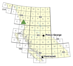
Geoscience BC and MDRU are pleased to be re-releasing these highly detailed maps to the public in a modern GIS format. Geoscience BC converted the original AutoCAD linework to topologically correct features in GIS format and the revised maps are now available as ArcGIS shapefiles and PDF digital maps. The three 1:50 000 scale maps cover an area of approximately 1512 km2 and include NTS map sheets 104B/08, /09, /10 and parts of 104B/01, /07, /11. They illustrate the complex volcano-sedimentary stratigraphy, structural architecture and intrusive complexity of this highly prospective region of the province and provide some of the most detailed and comprehensive mapping data available to the public for this region.
For more information on MDRU's Iskut River Project, go to the MDRU website at www.mdru.ubc.ca.