The Need
Reconnaissance-scale regional geochemical surveys (RGS) provide high-quality information that is used to guide mineral exploration activity. Since the 1970s over 76,000 RGS samples have been analyzed and archived. Reanalyzing the archived samples using modern analytical techniques improves the quality of the RGS database by providing better measurements of elements as well as an providing an expanded suite of elements for each sample. Starting the 2005 the BC Geological Survey and Geoscience BC have been reanalyzing RGS samples using inductively coupled plasma-mass spectrometry (ICP-MS) techniques. This project completes this reanalysis for six RGS surveys conducted between 1977 and 1990.
Project Benefits
As all samples were collected as part of earlier initiatives by the federal and provincial surveys, no new sampling was conducted in the field, thereby providing new geoscience for the mineral exploration community at a significantly reduced cost. In addition, reanalyzing these sample provides greater data continuity between surveys conducted at different times and/or originally analyzed by different laboratories.
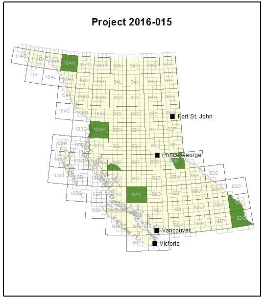
Survey Area
Seven NTS map sheets across BC including the Southern Rockies (2 sheets), Waddington, Whitesail Lake, McBride, Atlin and Nass River.
How was the data collected?
All samples analyzed in this project are archived in Ottawa, in storage facilities maintained by Natural Resources Canada. A portion of the archived sample was acquired, with samples in parts or insufficient quantity of remaining pulp excluded. Analytical quality was checked using blind duplicate samples and control reference material. All samples were reanalyzed at the same laboratory using the sample protocols, making all data directly comparable.
What was found?
The new ICP-MS results were released in Microsoft Excel (xls) format, packaged with the original datasets. The new data is now available for industry, government, First Nations, and communities to use and interpret. Geoscience BC project (2016-028) undertook additional analysis of this new dataset.
 Since inception Geoscience BC has worked with the federal and provincial geoscience agencies to add new value to provincial regional geochemical data. In 2016, this included reanalyzing over 5,500 stream sediment samples originally taken between 1977 and 1991 to show how they could indicate undiscovered minerals across British Columbia.