Summary
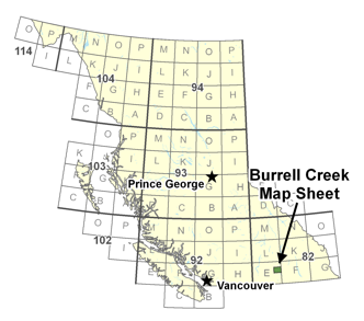
This project includes geological mapping and compilation of a large part of the 1:50,000 Burrell Creek map sheet 082E/09, located within the Columbia Mountains of southern British Columbia. The project is an extension to the north of the Deer Park map sheet project that was done in 2009.
The Deer Park project focused on the potential for Tertiary age mineralization within the southern Monashee Mountains along the northern margins of the Grand Forks gneiss complex and recognized and defined a variety of base metal and precious metal mineral deposits that appear related to prominent north and northwest-trending regional structures. The Burrell Creek project is intended to continue this work to the north, in an area that has attracted considerable historical exploration, due in large part to development of the Franklin camp, but has had little university or government exploration-led research since a regional (1:250,000) mapping project in the 1950s and a regional (1:250,000) compilation map done in the late 1980s.
The Burrell Creek map sheet is located along the eastern edge of the Penticton (082E) sheet, 60 km northwest of the Rossland Gold camp and approximately 50 km northeast of the Greenwood camp. The Franklin camp, comprising numerous past producing precious metal-lead-zinc-silver deposits is located in the south-western part of the sheet, and a few other mineral occurrences, of largely unknown character and age, are scattered throughout the rest of the map sheet. Recent exploration activity in the area has been largely concentrated in the immediate vicinity of the Franklin camp and in the Deer Park map sheet immediately to the south. An updated geology map for the Deer Park map sheet was released by Geoscience BC in 2010 as GBC Map 2010-07-1