Summary
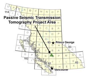 This project is the first phase of a proposed two phase project. The overall objective of the proposal is to demonstrate the utility of passive seismic transmission tomography (PSST) to map structure and sediment thickness beneath basalt flows within the Nechako basin. Specific objectives are: 1) to map the area outlined on the location map to determine if there is a sedimentary sub-basin underlying the gravity low; 2) to integrate the seismic data with the potential field and well data to obtain a detailed sub-surface interpretation of the region; and 3) to compare the results from the passive seismic survey with the 2D data collected in the 1980s.
The justification for selecting the outlined area near Big Creek was based on geophysical mapping (seismic and gravity) and drilling conducted by Canadian Hunter in the early 1980s. The PSST method utilizes local, small magnitude earthquakes (microseismic events) as a source for tomographic inversion of the ray paths to produce P- and S- wave velocity volumes within the subsurface. The resolution of the velocity volume depends on the seismic activity within and near the survey area, the number and location of the geophones, and the acquisition time. Areas with significant microseimsic activity require less time to reach the desired resolution for the velocity cube. The advantage of using the PSST technique in basalt covered areas is that the ray paths only travel through the basalt once, rather than twice as in conventional reflection seismic methods. There is very little environmental impact from the PSST method as well.
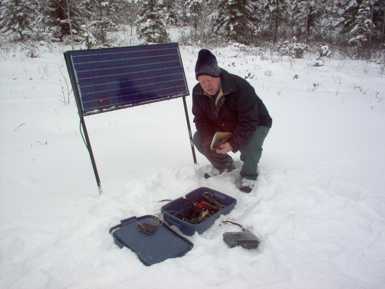
The first phase of this project consists of a reconnaissance test to ensure there is sufficient seismic activity within the study area to meet the objective outlined above. Five 3- component geophone arrays will be installed, one near each corner and one near the middle of the area outlined on the location map. Data will be collected at each site at a sampling rate of 2 ms for a period of 8 weeks.