Key Researcher(s): D. MitchinsonArrayW. Jackaman; D. Sacco
Project ID(s): 2018-047, 2018-050
Key Research Organization(s): Noble Exploration Services Ltd.; Palmer, University of British Columbia - MDRU
Project Location: Central Interior, North Central and South Central
Strategic Focus Area: Minerals
Summary
Central Interior Copper-Gold Research (CICGR) is a major multi-year Geoscience BC series of collaborative minerals earth science projects in British Columbia between the Mount Polley (Quesnel) and Gibraltar (Williams Lake) mines in the south, and the Mount Milligan (Mackenzie) mine in the north. It is designed to highlight potential mineral deposits buried under glacial deposits in order to focus mineral exploration, attract investment and assist more informed natural resource decisions.
Previous
Next
Central Interior Copper-Gold Research: Surficial Exploration Project
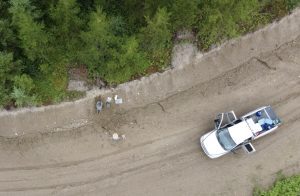
This project is generating new data about the layers of sediments deposited by glaciers (e.g. till) found in an area between the Mount Polley (Quesnel), and Gibraltar (Williams Lake) and Mount Milligan (Mackenzie) mines to provide a framework that can be used to trace till samples and geochemical anomalies back to their source, which may help to identify areas of potential mineral exploration interest.
This project is using existing Geoscience BC and other publicly available geophysical data to identify, map and model prospective copper-gold deposits and related rocks in the region of the Quesnel terrane between the Mount Polley (Quesnel) and Gibraltar (Williams Lake); and Mount Milligan (Mackenzie) mines that is covered by sediments deposited by glaciers (till).
Project Update – January 2023
Analytical results and a report for the regional subglacial till sampling and research have been published. These results infill dataset gaps identified during the reassessment of historic sample datasets. New geochemical and mineralogical analysis from over 1,500 samples combined with previously published surficial geology maps provide an improved understanding of the region’s mineral potential.
While the analytical work is being completed for research on the southern section of the study area, the maps for this area have been published.
There are Surficial Geology, Drift Thickness and Till Sampling Suitability Maps for NTS map sheets: 093A/13; and 093G/01, 07, 09, 10, 16.
Project Update – July 2021
The Geoscience BC team provided a brief update and high-level overview of the CICGR program and its two current projects:
• CICGR: Surficial Exploration Project: interim report, planned fieldwork for 2021 and next steps
• Identification of New Porphyry Potential Under Cover in Central British Columbia: project update
This online community open house was designed for communities, Indigenous groups, government staff, the mineral exploration sector and others interested in minerals research in central BC. More detailed, technical updates on each project will be organized when each project completes.
Project Update – April 2021
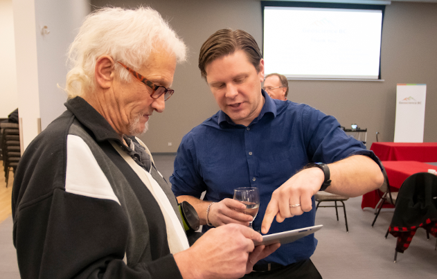
Geoscience BC researchers provided an update on the latest research from the Central Interior Copper-Gold Research (CICGR) project series as part of the 2021 Kamloops Exploration Group (KEG) Technical Talk Lunch Series on April 27, 2021. Dianne Mitchinson, Research Associate at the University of British Columbia’s Mineral Deposit Research Unit (MDRU), and Dave Sacco, Senior Surficial Exploration Specialist at Palmer, provided updates on their CICGR projects.
The Quesnel terrane is a distinct package of rocks that runs roughly northwest-southeast across the province and hosts significant copper-gold deposits. In the CICGR area, the Quesnel terrane is buried under thick glacial deposits. With the Mount Milligan copper-gold mine to the north and the Gilbratar and Mount Polley mines to the south, it is believed that similar mineral deposits may be hidden below the glacial deposits between these mines.
CICGR is made up of coordinated projects designed to characterize the nature of these glacial deposits including their genetic variability, depth to bedrock, chemistry, and origin. This is being accomplished through surficial mapping and sampling, geophysical interpretation, drilling and other techniques.
The information generated is contributing to understanding the region’s geology and mineral potential. It will provide data that can be used by the mineral exploration sector, governments, communities and Indigenous groups to more effectively focus attention on economic mineral exploration and development.
Benefits
Parts of the Quesnel terrane to the north and south of the project area host significant copper and gold deposits, and it is likely that undiscovered mineral deposits exist beneath the glacial deposits in the project area.
Understanding the characteristics and composition of the glacial deposits and the geophysical response of the underlying bedrock will assist in understanding regional mineral potential and will help to focus mineral exploration. Mineral exploration companies, communities, Indigenous groups and governments can use this public earth science information for planning and attracting investment.
Location Details
CICGR projects cover around 50,700 square kilometres of BC’s Central Interior (North Central and South Central Regions) and include communities such as Fort St James, Mackenzie, Prince George, Quesnel, Vanderhoof and Williams Lake.
This website uses cookies to improve your experience. We'll assume you're ok with this, but you can opt-out if you wish.AcceptRejectRead More
Privacy & Cookies Policy
Privacy Overview
This website uses cookies to improve your experience while you navigate through the website. Out of these, the cookies that are categorized as necessary are stored on your browser as they are essential for the working of basic functionalities of the website. We also use third-party cookies that help us analyze and understand how you use this website. These cookies will be stored in your browser only with your consent. You also have the option to opt-out of these cookies. But opting out of some of these cookies may affect your browsing experience.
Necessary cookies are absolutely essential for the website to function properly. This category only includes cookies that ensures basic functionalities and security features of the website. These cookies do not store any personal information.
Any cookies that may not be particularly necessary for the website to function and is used specifically to collect user personal data via analytics, ads, other embedded contents are termed as non-necessary cookies. It is mandatory to procure user consent prior to running these cookies on your website.